Early Maps of Hamilton County
By: Sherri Bonham
Maps are important in historical and genealogical research because they demonstrate the physical connections in a given area and display a place at a point in time. Here are some cropped images of three early maps of Hamilton County.
Original Land Grant Map
This is a small section of the Original Hamilton County Land Grant Map. It records the names and dates of property sold by the federal government to individuals starting in 1822. This section shows land purchased by William Conner, some of which later became Conner Prairie.
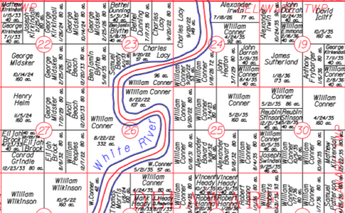
There is a copy of this entire map in the Indiana Room plus a name index to the map. It is also available on the Hamilton County Surveyor’s webpage.
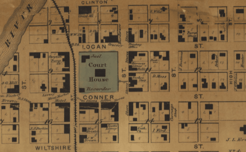
Early Map of Noblesville
This is a section of a map of Noblesville dated 1866, only 44 years after the land purchase map above! Notice the Courthouse Square has different outbuildings. In addition, this courthouse would have been the “Old Brick Courthouse”, completed in 1837, which was replaced with our current courthouse in 1879.
You can find this entire map in the upper right-hand corner of the Map of Hamilton County Indiana 1866, both in the Indiana room and on the Surveyors webpage. The Surveyor’s site provides individual section maps of several townships and towns.
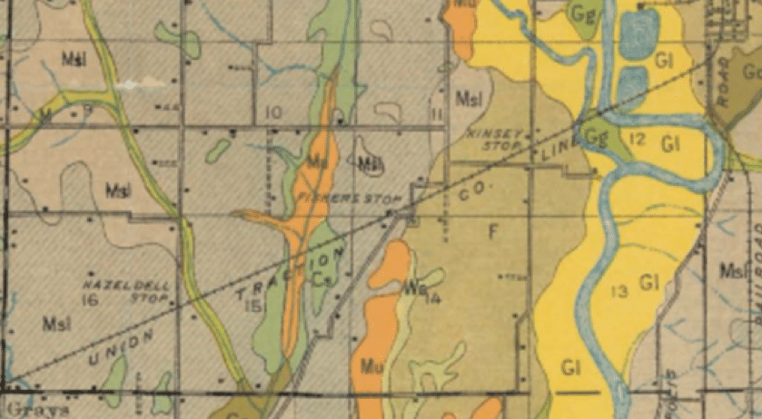
Soil Map
Next, we have a small section of the 1912 Soil Map of Hamilton County. The multicolored areas indicate the soil type or properties in the soil. Other points identified are communities, railway lines and railway stops. Reading left to right on the Union Traction Company line, find the Hazel Dell Stop, the Fishers Stop and the Kinsey Stop!
The 1912 Soil Map is also available on the Surveyor’s webpage and in the Indiana Room.