


The Mystery of the Missing Map
By: David Heighway, Hamilton County Historian
There are many good online databases available for researchers today, several of which are linked on the Indiana Room page. These cover items like books, photographs, and newspapers. Since they are scanned original documents, this puts primary sources within easy reach.
I have a particular interest in maps. Local maps can be great for defining how people moved around in an area and showing why it grew the way it did. I use them for tracking adventures and events like the Blackberry Campaign, the route of the canals, and Gas Boom sites.
Hamilton County has some good online resources for map work – primarily the Hamilton County Surveyor’s web page, the Indiana State Library, or here, and the Library of Congress. At the Library of Congress, I’ve found maps dating to the very earliest exploration of this area by Europeans.
However, one map is apparently missing from all of these sources. There is a report in the June 4, 1875 issue of the Noblesville Ledger that C. A. Hubbard & Co. had published a new map of Hamilton County. The article said that it was detailed and accurate, with “photographic views of the fine mansions” of several residents, and all of the material “constituting a condensed compendium of information rarely embraced in a publication of the kind.”
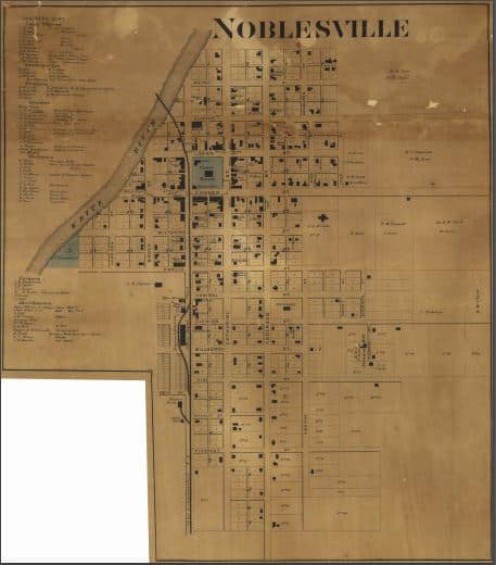
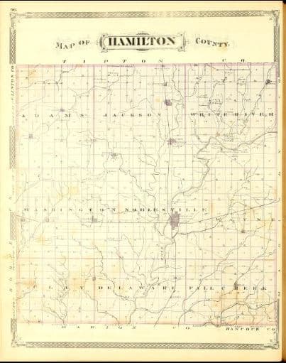
I have never seen nor heard of a copy of this map. We have the 1866 map published by McClellan & Warner that I’ve written about before, the 1876 state atlas published by Baskin, Forster & Co., and the 1880 illustrated county history published by Thomas Helms – all of which are available online. We know the 1875 map actually existed because the Indianapolis Public Library entered it into their collection sometime between 1876 and 1878. They recorded its size as being four feet by four feet square. Of course, it’s not in their catalog now.
 Now, the map may just be a repeat of information found in the other maps (publishers could be very casual about copyright in those days). However, it might have something that hasn’t been available before. The article says that the map has an image of the (then) brand-new Citizen’s Bank building (which is now the Copper Still restaurant). This may be the earliest image of the structure and has been found nowhere else.
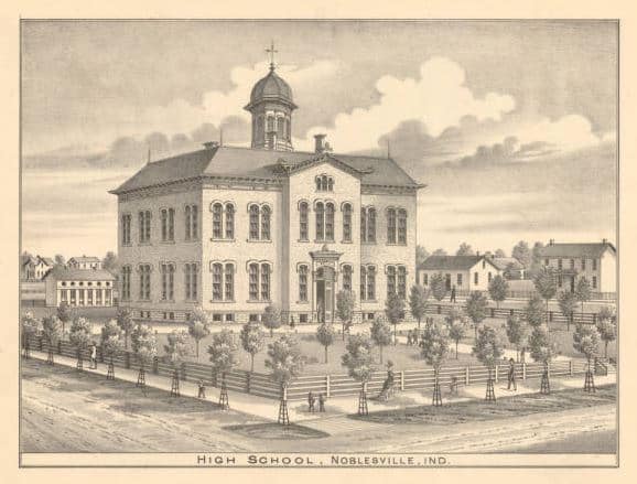
Other images that are mentioned in the article are the Noblesville high school (a version of which is in the 1880 history), the Noblesville home of Joseph R. Gray and the Atlanta home of Asher G. Walton, (both are also in the 1880 history and still standing today), and the Noblesville Township home of Elias Gascho and the Abraham Laudig home in Jackson Township, (which don’t have images elsewhere).
Like the 1866 map and the 1880 history, property owners are identified. It would be interesting to compare it to the 1874 county directory that I’ve written about before. The map also marks all of the schools and churches, and shows the plats of all of the “important” towns.
We hope that in the future, if the map ever does turn up, someone will digitize it so that we can link it on the library web page as being yet another source for county history. Making the material accessible to the public is central to what we do. After all, libraries are information nodes that compile sources, electronic or otherwise, so that you can find what you need.